Welcome to Tulare County Fire Department Fire Hazard Severity Zone (FHSZ) information hub. This site provides comprehensive information about the rollout of updated fire hazard severity zones within the Local Responsibility Areas (LRA) of Tulare County. In accordance with Government Code Section 51178.5, Tulare County is mandated to facilitate public access to the proposed map and host a public comment period.
It is important for the public to understand that this is a state-mandated local program (Assembly Bill No. 211) and these maps are created by the California Department of Forestry and Fire Protection (CAL FIRE) under the direction of the State Fire Marshal. Our local fire agency does not control the creation of the map but is required to ensure the community has the opportunity to review and provide feedback.
California Government Code Section 51179(a) mandates that local agencies "shall designate, by ordinance, moderate, high, and very high fire hazard severity zones in [their] jurisdiction within 120 days of receiving recommendations from the State Fire Marshal pursuant to Government Code Section 51178. The Tulare County Fire Department (TCFD) received these maps on March 10, 2025.
These maps aim to provide valuable information for land use planning, building code enforcement, and wildfire risk mitigation strategies. Public input can help identify concerns, validate data, and improve the understanding of how these zones may impact residents, businesses, and emergency response planning.
We encourage all residents and stakeholders to review the proposed maps, ask questions, and submit their comments. Your participation is a vital part of this state-mandated process and contributes to a safer, more informed community.
Government Code 51178 The State Fire Marshal shall identify areas in the state as moderate, high, and very high fire hazard severity zones based on consistent statewide criteria and based on the severity of fire hazard that is expected to prevail in those areas. Moderate, high, and very high fire hazard severity zones shall be based on fuel loading, slope, fire weather, and other relevant factors including areas where winds have been identified by the Office of the State Fire Marshal as a major cause of wildfire spread.
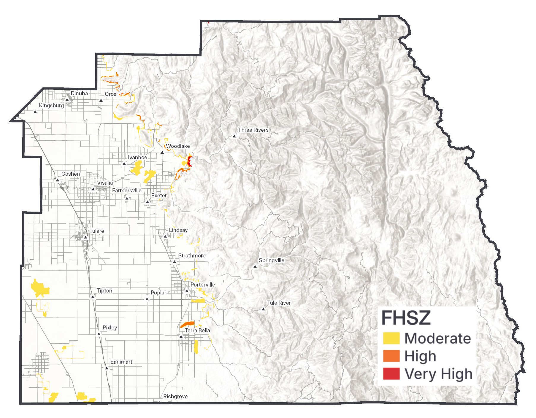
Below are links to the latest 2025 Fire Hazard Severity Zone maps for Tulare County 2025.
The public comment period is open effective March 19, 2025.
The map is scheduled to be presented to the Tulare County Board of Supervisors for adoption after the public comment period closes. Public comments will be included as we make the presentation. The comment period will close on April 19, 2025, at 11:59 PM.
Note: Government Code section 51179: "Local agency is not allowed to reduce the designation of a FHSZ classification from the State Fire Marshal".